I just started using Sen2agri system, I am trying to upload my shapefile, but I get this message “Cannot get site lists! Please check that the sen2agri-services are started!”. Please how can I solve this problem?
If I understand correctly, you are trying to create a site using actually the insitu data shapefile.
When creating the site you should provide an archive containing the simple shapefile with the extent of the site (the region that you intend to process) and not the insitu data. The insitu data can be provided after defining the site and the season for the site (the interval for downloading and processing) and this operation is done by editing an existing valid site.
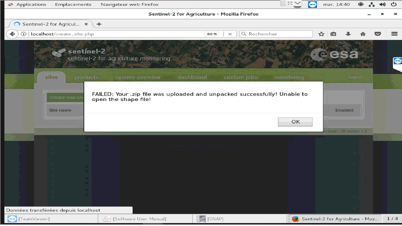
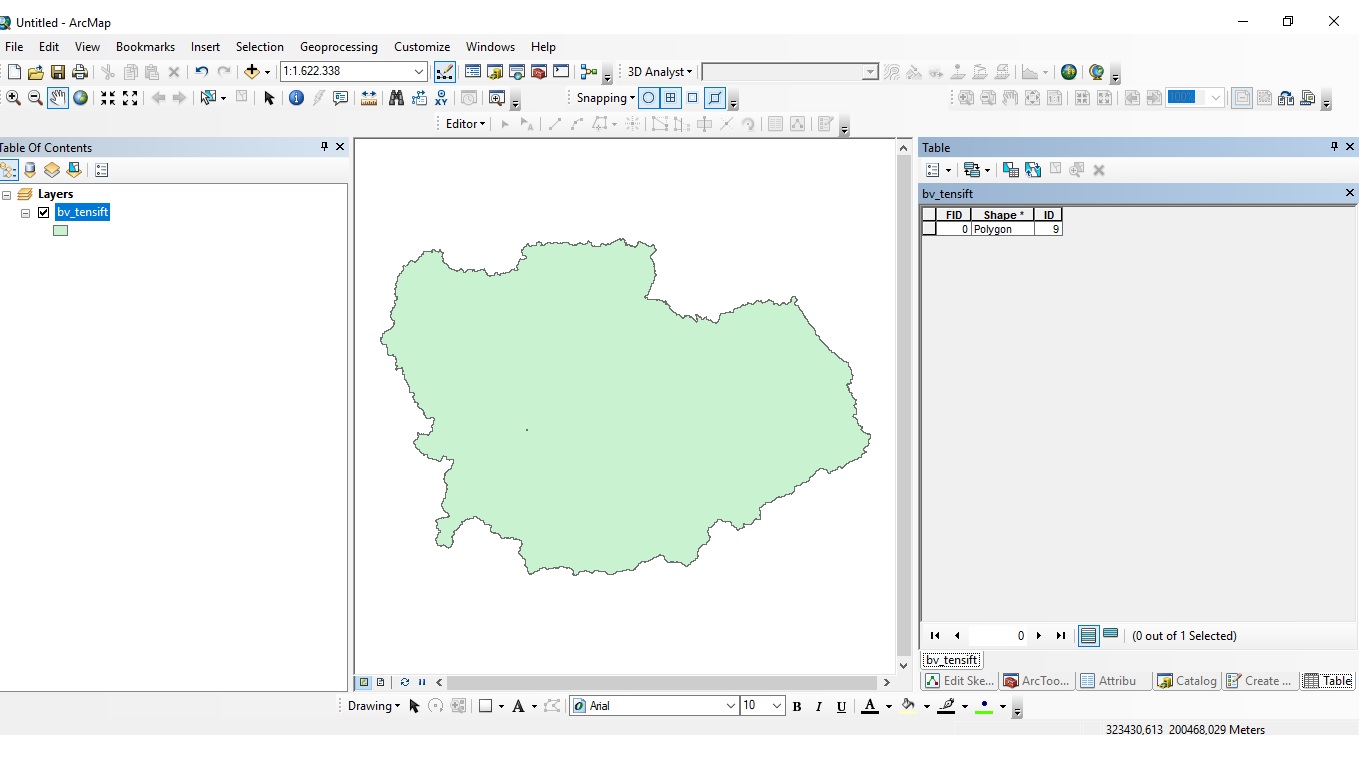
Many thanks for your help. Yes exactely you’re right, I uploaded shapefile with insitu data last time. Now, I changed the shapefile by another one containing the extent of my region, showed in the following attached screenshot:
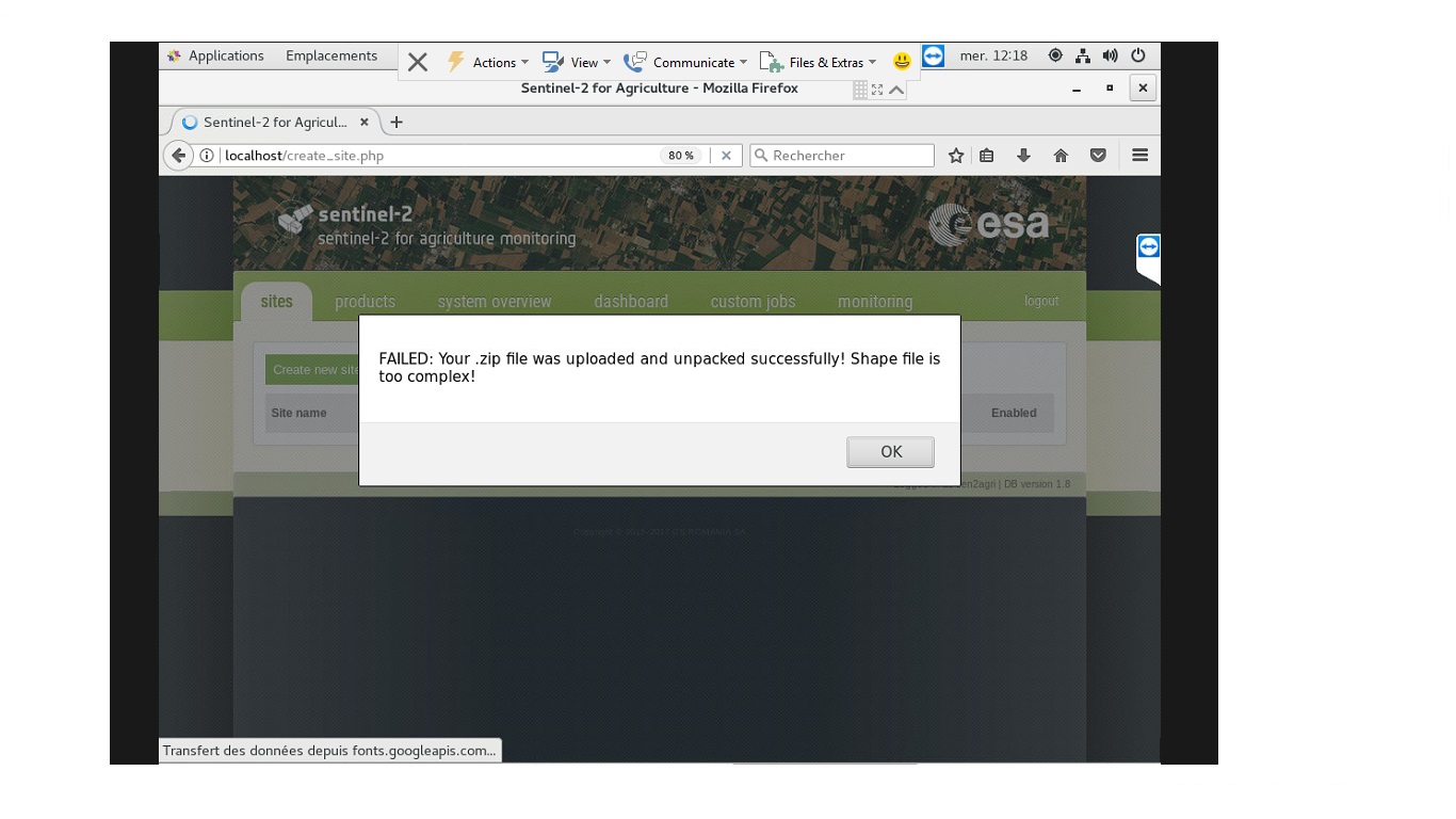
I think the problem is that your shapefile contains too many vertices.
The request to ESA SciHub (for retrieving the list of products for your site) will fail as it would become very large.
This is why, the application rejects this shapefile as the system will not work with it.
Could you simplify your shapefile to a smaller number of vertices and try again, please?
Specifically, the check in cause is for more than 1580 vertices. However, that limit is completely arbitrary, and has no relation to what SciHub will actually accept (which is probably much less than that).
Note that this shapefile is only used for display purposes and to determine the tiles to download / use. Because of the tile overlap, though, you’ll most likely want to define a tile filter, which is a list of the tiles you actually want. So the shapefile accuracy doesn’t matter much.
I also tried the following line , but it changed nothing:
$ [sudo] journalctl -u sen2agri-orchestrator -u sen2agri-scheduler -u sen2agri-executor --since …